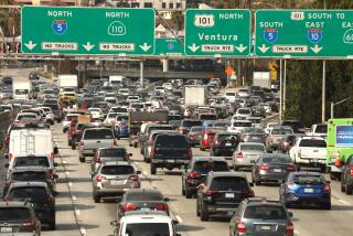
Waze, Caltrans will share data to ease traffic nightmares
Caltrans is partnering with the popular smartphone app Waze to help California drivers get where they’re going without getting stuck in traffic.
Or at least not getting stuck in as much traffic.
Under an agreement announced Tuesday, Waze will provide Caltrans with the real-time data it gathers from its millions of users. Caltrans will post that information on its QuickMap app and its website quickmap.dot.ca.gov.
In exchange, Caltrans will provide Waze with information on road closures, construction projects and other conditions that can tie up traffic.
“Combining the real-time anonymous data from Waze, sourced from drivers themselves, with Caltrans’ vast network of traffic management systems is a win-win for California drivers,” Caltrans Director Malcolm Dougherty said.
Waze says it is the world’s largest community-based traffic and navigation app, with 1.7 million monthly users in Los Angeles and 678,000 in San Francisco.
The app is free, and people who use it automatically provide information on traffic conditions as they travel from Point A to Point B. That information is shared in real time with other users.
Drivers can also proactively provide information to Waze on such things as speed traps, stoplight-based cameras that can catch people running red lights, and stalled cars or police activity that might slow a commute.
“Waze is only as strong as the information it receives from its users,” said Paige Fitzgerald, Connected Citizens Program manager for Waze. “The immense data Caltrans can contribute to the Waze app makes them a valued partner.”
More to Read
Sign up for Essential California
The most important California stories and recommendations in your inbox every morning.
You may occasionally receive promotional content from the Los Angeles Times.


