Editorial: Restore California’s floodplains to capture more stormwater, protect human life
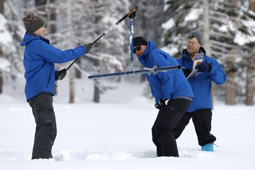
The southern Sierra Nevada is covered with the deepest snowpack in recorded history, and the rest of the range is not far behind. When all that snow melts, where will it go?
You can read the answer in the landscape of the Central Valley. To the eye it is nearly flat, covered by layers of gravel, silt and clay washed from the mountains over the eons by rain and melting snow. Amid the flatness are gradual slopes down to the valley’s center, where the Sacramento River creates a watery vein in the north and the San Joaquin River does the same in the middle. Once — before the late 19th century, when newcomers began to drain the land and channel the water from wetlands into farm fields — the southern part of the valley held the largest freshwater lake, by surface area, west of the Mississippi.
Many smaller California valleys likewise feature rivers, including the Salinas, that are often nearly dry but flood their banks in wet years like this one because of torrential rain rather than snowmelt.
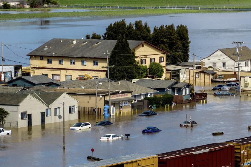
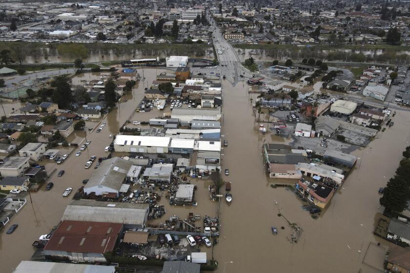
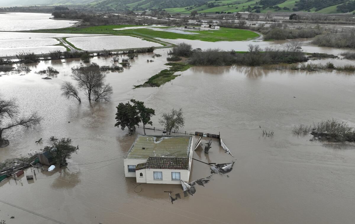
That’s where the water goes: to the valley floors, swelling the rivers in flood years until they overflow their banks, imperiling communities like Pajaro and the people in them.
During the Great Flood of 1861-62, water covered the entire Central Valley. It would have been possible to sail from what was not yet Bakersfield, north past the flooded Capitol in Sacramento, almost to where Redding now sits.
An incoming storm threatens to overflow the swollen Salinas River, imperiling the lives of farmworkers and crops and triggering evacuations.
In drier times, though, those same flat floodplains looked especially attractive to farmers and builders, so now the valley floors are cultivated and developed. But in wet years like this one, all that rain, as well as the melted snow, still needs a place to go, and it doesn’t pay any attention to human development. It still seeks the lowest ground, and it will find it. A quick look at a satellite photo of the snow-covered Sierra makes it plain: No number of dams can hold all that water back, no number of reservoirs can lock it up.
The solution is shockingly simple, relatively cheap — compared with the cost of cataclysmic floods — and surprisingly non-controversial. We just haven’t yet done it on the scale that’s needed.
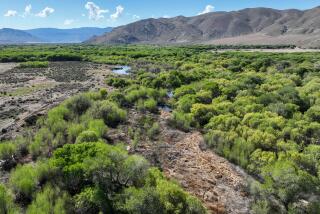
California needs to restore its floodplains. Not the whole valley floors, and not as they were in the pre-development era. But it needs to have many more acres of land reserved for floodwater.
Restoring floodplains requires setting aside low-lying inland areas for water to accumulate away from homes and critical infrastructure. It’s as easy as moving levees. Instead of building them ever taller, to hustle rushing water out to sea, levees set back from riverbanks give the water a place to slow down, settle and seep into the ground, safely away from human habitation and commercial investment.
It was never the right word for the West’s water woes. We are deep in water debt and a single wet winter isn’t going to make us flush again.
There are multiple benefits. The first is, of course, protecting life and property, because floodwaters are given a place other than city streets to gather. Beyond that, water that settles over floodplains percolates into the soil and, where the geology permits, recharges groundwater that has been dangerously depleted by agricultural over-pumping.
And restoring floodplains restores seasonal wetlands, which is good for the entire natural web that holds California together — including native plants that are less likely to burn during fire season than invasive species, fish that regain spawning habitat, migratory birds that find nesting areas, mammals that can once again migrate across the valley.
In dry seasons, restored floodplains can be wildlife preserves. But they also can be soccer fields, golf courses, even farm fields for annual crops like tomatoes or melons. Just not homes or perennial crops such as almonds.
Some homes are already standing where floodwaters are naturally prone to gather, and that poses a quandary. Do we protect them from floodwater at any cost, or abandon them to it? The questions are the same as with homes destroyed by wildfire, and whether it is society’s duty to protect people who choose to rebuild in an area at risk from fire, flood or other predictable disasters. There is no consensus. As with coastal neighborhoods threatened by rising sea level, in some cases the prudent and cost-effective move will be a managed retreat from riverbeds that could flood, even if they are dry most years.
The Pajaro River levee failure points to hazards that California has yet to address in many areas where communities are vulnerable, experts say.
All that’s missing in restoring floodplains is the will, and enough money to buy land, usually farmland that has become too costly to keep under cultivation. Gov. Gavin Newsom is touting his decision to use some of this year’s overabundant rain to recharge groundwater. But he also cut most floodplain restoration funding from his proposed budget for the third straight year.
In years like this one, in which the state seems to have more water than money, a floodplain restoration advocate’s thoughts may turn to the ballot. A well-crafted bond measure could give a serious push to necessary restoration efforts. Even though flooding threatens the state today, a bond might easily land on the ballot in a parched year when atmospheric rivers, historic snowpacks and submerged highways are long forgotten. But whether it’s a budget allocation or a bond, let’s try to remember: There will be even wetter winters, and restored floodplains can protect homes and capture water for use in bone-dry summers.
More to Read
A cure for the common opinion
Get thought-provoking perspectives with our weekly newsletter.
You may occasionally receive promotional content from the Los Angeles Times.
