California snowpack hits record low
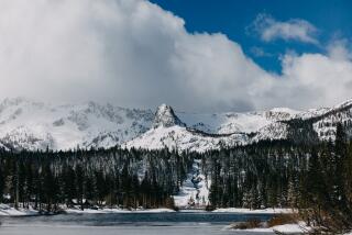
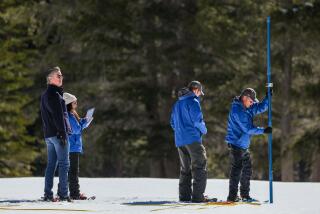
Even with the first significant storm in nearly two months dropping snow on the Sierra Nevada, Thursday’s mountain snowpack measurements were the lowest for the date in more than a half-century of record keeping.
At 12% of average for this time of year, the dismal statewide snowpack underscored the severity of a drought that is threatening community water supplies and leaving farm fields in many parts of California barren.
As snow survey crews worked, Gov. Jerry Brown met with Southern California water leaders as part of a series of drought meetings he is holding around the state.
“Every day this drought goes on, we’re going to have to tighten the screws on what people are doing,” Brown said in brief remarks before the private meeting with regional water managers at the downtown Los Angeles headquarters of the Metropolitan Water District of Southern California.
Brown earlier this month declared a state drought emergency and called on all Californians to cut water use by 20%. “Make no mistake,” he said Thursday. “This drought is a big wake-up call and a reminder that we do depend on natural systems. It’s not just going to the store.”
Thanks to billions of dollars of ratepayer investments in regional water storage projects and conservation programs, Southern California is in a stronger position than much of the rest of the state. “We spent 20 years preparing for a drought like this,” MWD General Manager Jeffrey Kightlinger said.
The agency, which supplies the Southland with water from the Colorado River and Northern California, has no plans to impose rationing this year. But Kightlinger is asking the MWD board to issue a formal alert, emphasizing Brown’s call for conservation, and wants the board to dip into the agency’s general reserve fund to double annual conservation spending to $40 million.
The money would fund public outreach and consumer rebates for water-efficient appliances and sprinkler systems.
Kightlinger also said MWD would be open to forgoing some water shipments and transferring them to needy districts in other parts of the state if enough storms come along in the next two months to raise the level of depleted reservoirs upstate.
But “right now we don’t even have those supplies in Northern California,” he said. “Frankly, I’ve never seen anything like it.”
MWD officials and Brown also discussed a $25-billion proposal to replumb the Sacramento-San Joaquin River Delta with a new diversion point and two water tunnels. Brown and major water contractors including MWD are pushing the project as the best way to ease endangered species restrictions that have cut water deliveries to the Southland and San Joaquin Valley agriculture.
When President Obama this week phoned Brown about the drought, Brown said he told the president that some “lower level” federal officials involved in the project “are not being helpful. Quite the opposite.”
Kightlinger, elaborating later, said the Brown administration and water contractors were frustrated by the pace of review by federal agencies that must approve the project.
“We’ve been working on it now over seven years,” Kightlinger said. “We’ve spent $200 million-plus dollars in planning alone and we need high-level federal engagement to wrap this up.”
Until Thursday, the lowest statewide snowpack measurement at this time of year was 21% of average, in 1991 and 1963. The one bit of good news Thursday was that it was snowing in the Sierra.
The storm arrived Wednesday evening and, combined with a second wave of moisture Thursday night, was expected to dump one to two feet of snow on slopes that have been so bare that mountain bikers were climbing them in the middle of January.
The U.S. Forest Service on Thursday issued an oddly welcome warning of backcountry avalanche danger between the Yuba and Ebbetts passes “due to new heavy snow slabs.”
Dawn Johnson, a meteorologist with the National Weather Service in Reno, said two low pressure systems in recent days managed to split in half the persistent high pressure ridge off the West Coast that has blocked winter storms.
“That finally opened up the door” for a track of tropical moisture from Hawaii, she said. A cold front from the Gulf of Alaska turned the initial rain to snow in the mountains and foothills. The system, extending from the Oregon border, was largely spent by the time it reached Southern California and forecasters said the Los Angeles area would get no more than a tenth of an inch of rain.
Although another low pressure system could bring precipitation to the California coastline Sunday night, Johnson said there was no way of knowing if the storm door will remain open next month, or slam shut.
